Tom Paul Trail
 This
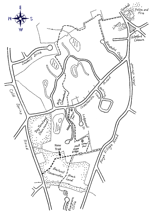
trail starts from Main Street directly across the street from the Town
Hall, between a stone wall and a driveway. The trail from Town Hall to
Evergreen Circle is about 2 miles long, beyond which the trail extends
another ¾ mile to the Stone Arch Bridge. Yellow diamonds, This
trail starts from Main Street directly across the street from the Town
Hall, between a stone wall and a driveway. The trail from Town Hall to
Evergreen Circle is about 2 miles long, beyond which the trail extends
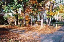
another ¾ mile to the Stone Arch Bridge. Yellow diamonds, ,
mark the trail for most of its length. Much of the beautiful woodland
through which the trail passes is permanently preserved open space belonging
to Blanchard Farms. Please keep to the defined trail which is a limit
of the trail easement. ,
mark the trail for most of its length. Much of the beautiful woodland
through which the trail passes is permanently preserved open space belonging
to Blanchard Farms. Please keep to the defined trail which is a limit
of the trail easement.
 From
Main Street, the trail begins in a northwesterly direction passing along
a stone wall on the right of the trail. After 850 feet, turn right for
225 feet, then go left downhill a short distance to a large rock (Raymond's
Rock). Turning left, go down an old colonial road between two rock walls
for 450 feet. Then turn left for 250 feet. Then turn right, leaving the
old road. Continue 400 feet to a large oak tree. Cross a stone wall, proceeding
400 feet to a tall and straight White Pine tree. From
Main Street, the trail begins in a northwesterly direction passing along
a stone wall on the right of the trail. After 850 feet, turn right for
225 feet, then go left downhill a short distance to a large rock (Raymond's
Rock). Turning left, go down an old colonial road between two rock walls
for 450 feet. Then turn left for 250 feet. Then turn right, leaving the
old road. Continue 400 feet to a large oak tree. Cross a stone wall, proceeding
400 feet to a tall and straight White Pine tree.
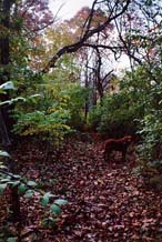
 Next
turn left, and cross a stream. About 60 feet further, turn right and cross
a stone wall. After another 50 feet, on the right is a large fallen oak
tree balancing on another tree, 4 feet above the ground. Continue on,
crossing another stone wall, bearing right to go over a small hilltop
(about 200 feet) and then bear right again. Cross another stone wall after
about 200 feet, and turn right. Go down hill, approaching a pond, and
turn left to walk along the side of the pond. This leads to an embankment,
which the trail goes over, then crossing Blanchard Road. Next
turn left, and cross a stream. About 60 feet further, turn right and cross
a stone wall. After another 50 feet, on the right is a large fallen oak
tree balancing on another tree, 4 feet above the ground. Continue on,
crossing another stone wall, bearing right to go over a small hilltop
(about 200 feet) and then bear right again. Cross another stone wall after
about 200 feet, and turn right. Go down hill, approaching a pond, and
turn left to walk along the side of the pond. This leads to an embankment,
which the trail goes over, then crossing Blanchard Road.
 On
the other side of Blanchard Road, the trail proceeds to the left (west)
along a stone wall. After 300 feet, bear right going downhill to cross
another stone wall, by a small pond. Continue walking along a wall in
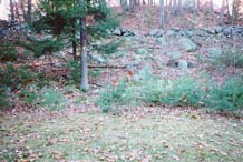
a westerly direction, passing a large rock outcropping
and passing over a small footbridge, and then crossing another stone wall.
Here the trail proceeds uphill, in an area of very large rocks, and continues
to Graniteville Road. On
the other side of Blanchard Road, the trail proceeds to the left (west)
along a stone wall. After 300 feet, bear right going downhill to cross
another stone wall, by a small pond. Continue walking along a wall in
a westerly direction, passing a large rock outcropping
and passing over a small footbridge, and then crossing another stone wall.
Here the trail proceeds uphill, in an area of very large rocks, and continues
to Graniteville Road.
 Cross
Graniteville Road with a jog to the left of about 120 feet (prior to Ledgewood
Drive). The next section of trail enters between two stone walls. A vernal
pool forms in this area in the spring. The trail proceeds about 600 feet
and then crosses to the left through a stone wall and proceeds along the
left side of this wall. Beyond the last house on Lodgewood Drive, the
trail turns to the left, and then passes through another stone wall into
a woodland. This woodland is part of the permanently preserved open space
of Blanchard Farms. After crossing this wall, turn left and proceed (south)
along the wall. After 300 feet, the trail turns to the right. It crosses
two small streams, and leads to an interesting old colonial road, defined
by a pair of stone walls. Here the trail goes in both directions. To the
left leads to Forge Village Road (450 feet). Proceeding to the right (toward
the Stone Arch Bridge), there is an old colonial stone bridge brook crossing
about 150 feet ahead. After another 60 feet, there is a large oak tree. Cross
Graniteville Road with a jog to the left of about 120 feet (prior to Ledgewood
Drive). The next section of trail enters between two stone walls. A vernal
pool forms in this area in the spring. The trail proceeds about 600 feet
and then crosses to the left through a stone wall and proceeds along the
left side of this wall. Beyond the last house on Lodgewood Drive, the
trail turns to the left, and then passes through another stone wall into
a woodland. This woodland is part of the permanently preserved open space
of Blanchard Farms. After crossing this wall, turn left and proceed (south)
along the wall. After 300 feet, the trail turns to the right. It crosses
two small streams, and leads to an interesting old colonial road, defined
by a pair of stone walls. Here the trail goes in both directions. To the
left leads to Forge Village Road (450 feet). Proceeding to the right (toward
the Stone Arch Bridge), there is an old colonial stone bridge brook crossing
about 150 feet ahead. After another 60 feet, there is a large oak tree.
The original Tom Paul Trail turns left at this point, but beavers have
built a huge dam across Boutwell Brook right where the trail crosses.
You have two choices. If you continue straight (north), you can follow
a new trail, which was constructed to circumvent the beaver dam. It's
a beautiful walk and leads to Cold Spring Road, at which point you will
follow the road left (west), returning to the main trail after you cross
Pine Ridge Road. A sign marks the place where the trail leaves Cold Spring
Road.
Alternatively, you can follow the original route for about 800 feet proceeding
along another old roadway, bounded by a pair of stone walls, and cross
Boutwell Brook using the beaver dam. This is easiest in the fall when
the water is low, but still possible in the spring for people with good
balance and good boots.
After the beaver dam, the trail continues to the pond at Evergreen Circle,
passing along the right side of the pond. Cross the road (Evergreen Circle),
and proceed along the left side of the road to Pine Ridge Road. Beyond
this point, the trail proceeds through Town Forest and emerges at Cold
Spring Road opposite the trail head for the Stone
Arch Bridge.
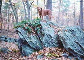
Rock Outcropping |
Tom Paul |
